Project Maestro - 5 Wind Farm Projects5 Whole Project Awards:Gordanstown Hill Wind Farm, Aberdeenshire
Wingates Wind Farm, Northumberland
Blackstone Edge Wind Farm, South Yorkshire
Westfield Wind Farm, Fife
Tedder Hill Wind Farm, East Riding of Yorkshire |
|
Project Team
Client: Infinis
Design & Construction: Jones Brothers, CA Blackwell & RJ McLeod
Contractor: Nordex
-------------------------------------------------------------------------------------------------------------------------------------------------------------------------------------
Project summary
Project Maestro is Infinis' development of five wind farms in Scotland and northern England, with a combined capacity of 52.5 MW. As such it is the largest wind farm development project to be assessed by CEEQUAL and follows on from Infinis' Glenkerie site, which in 2011 became the first renewable energy project to be recognised with a CEEQUAL award.
The five Project Maestro sites Gordonstown Hill, Aberdeenshire (12.5 MW); Wingates, Northumberland (15 MW); Blackstone Edge, South Yorkshire (7.5 MW); Westfield, Fife (10 MW); and Tedder Hill, East Riding of Yorkshire (7.5 MW)), bring Infinis' installed capacity of renewable energy on 147 sites spread through out the United Kingdom to 610 MW. With a commitment to develop additional wind farms with at least 100 MW of new capacity, Infinis intends to learn the lessons from Glenkerie and Maestro to further improve on the sustainability of each project.
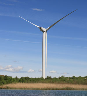
Gordanstown Hill Wind Farm
Challenges faced and Achievements
Physical Resources Use & Management, Tranport, People & Communities
A common feature across all of the sites was a desire to reduce material use as far as practicable. In addition to the wider sustainability benefit of using less resources and reducing transportation of material, this helps local communities by reducing vehicle movement, a common area of concern. The standard Infinis approach for wind farm site construction is the 100% re-use and re-laying of excavated materials and top-soil respectively. All materials excavated and removed to allow for WTG foundations and access roads are to be re-used in the construction of the wind farm access roads and re-dressing of crane hardstandings/turbine foundations as appropriate. No material is to be disposed of as waste. |
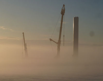
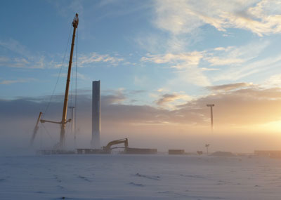
Gordanstown Hill Wind Farm in construction phase (pictures above and below) |
|
For Blackstone Edge, Wingates, and Westfield this was fairly straightforward. Re-use and re-landscaping was implemented as part of the construction of the access roads etc. For Gordonstown Hill, excess material was also used creatively, re-landscaping areas of the landowners’ fields/land to improve use of the land for agricultural purposes. A novel ground stabilisation technique was applied at Tedder Hill and Wingates as part of the engineering solution for the crane hardstandings/access track designs. At Wingates, it was applied to the hardstanding (crane pads) only and its use in the construction of the crane pads dramatically decreased the amount of material required to be imported to site, (e.g. 514 cubic metres of stone per hardstanding would otherwise have been required). At Tedder Hill it was used across the site for both hardstanding and access tracks. The construction method used was soil stabilisation to a depth of 400mm with a 100mm stone cap running surface over Geogrid. |
 |
In addition to the ground stabilisation outlined above, geotextile was used for the access tracks at Gordonstown and Wingates. The use of geotextile technology was applied to the construction of the access roads which decreased the amount of material required to be imported to site.
Water Environment
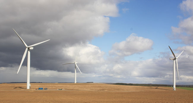
Westfield Wind Farm |
|
At Wingates and Blackstone Edge, the new drainage ditches, culverts and attentuation for surface water run off from surrounding land, hardstanding and new haul roads were designed to incorporate increased flooding to the level of 1 in 100 year plus climate change event. The Surface Water Drainage Strategy incorporated a design for a larger event/greater flood resilience than required (by EA or planning conditions), even though flooding was thought relatively unlikely. At Westfield, the development was built on a site which has areas which are defined as being at flood risk according to SEPA's data, with the Lochty Burn subject to flooding. Extensive flood risk assessment work was conducted for the project, which took into consideration the 0.5% annual probability plus climate change (20%) flood event. In the assessment of flood risk, the methodology and objectives incorporated the statement that "the development should meet all of the above criteria for its entire lifetime, including consideration of the potential effects of climate change." The cut and fill for the development was designed so as to overcompensate the flood plain for flood storage such that there will be no detriment during flood events up to the 200 year event. |
Finally, at Tedder Hill, there has been extensive flood risk assessment work conducted for the project, which assesses the risk of flooding to the site, the possible effect of the development on flood risk elsewhere and makes allowances for increased flows due to climate change. The site has areas which are defined as being at high flood risk according to Environment Agency data, with Turbines 2 & 3 located in an area prone to flooding. A full Flood Risk Assessment (FRA) was undertaken in the environmental report & planning application stages of the development which was accepted by the EA. The EA subsequently reviewed their position and requested a revised FRA due to the change of Planning & Flood Risk Guidance note and the occurrence of a major flood event in June 2007. The revised FRA was produced in 2008 and followed PPS65 which requires the increased surface water runoff rates and volumes to be quantified and attenuated to the greenfield runoff rates and volumes for the 1 in 100 year flood event plus climate change. An attenuation pond and drainage swale ditches have been designed so as to compensate the flood plain for flood storage such that there will be no detriment during flood events up to the 100 year event plus climate change. The Drainage Strategy and Culvert Sizing Calculations for the project support this approach.
Ecology and Biodiversity
Please view the following document for information on the ecological protection strategies for the 5 wind farm developments:
Ecological protection note for Project Maestro
To what extent did the use of CEEQUAL influence your project?
For a company committed to the highest standards of Corporate Social Responsibility in developing a portfolio of sites, CEEQUAL has been invaluable. It has allowed us to measure the sustainability of our development projects and compare these both across Infinis and with developments by others. Following the maxim "what gets measured gets managed", we have adopted the lessons learned from our Glenkerie site (which was the first wind farm to be recognised by CEEQUAL) and applied these to and within this portfolio of projects. We are now applying the lessons learned through the application of CEEQUAL to subsequent rounds of wind farm development.
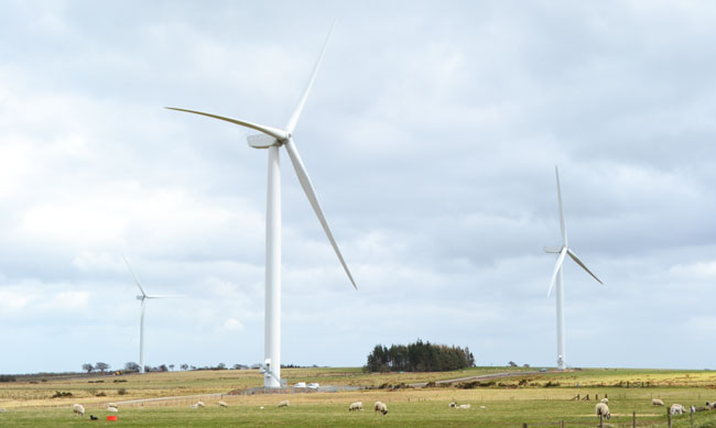
Blackstone Edge Wind Farm

